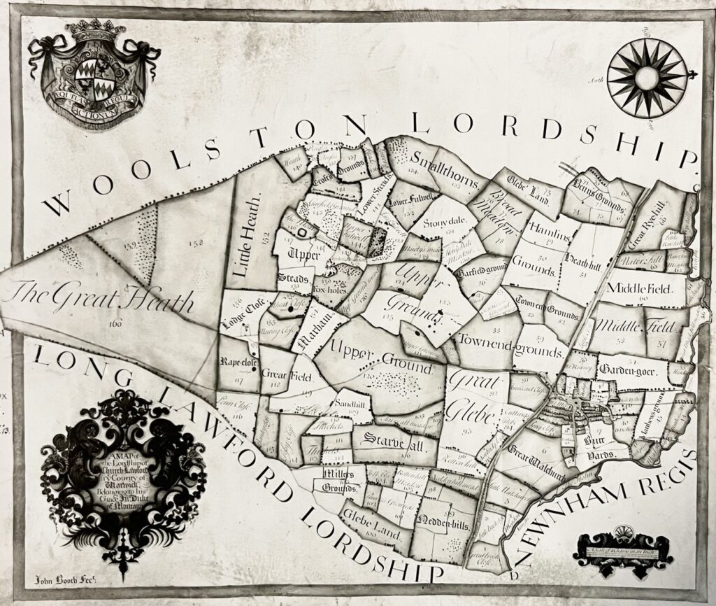
A Tithe map for the village, along with details of farmers and villagers for around 1720 has been kept in the records of Lord John Scott and published or referenced in various locations. A copy of the Lord John Scott maps are held in the Warwick Records Centre – the originals are in the Montagu Family Archive.

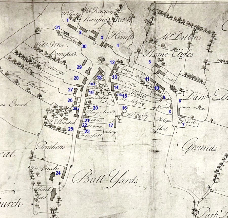
Householders in the village centre are listed on a more detailed historic map included below. As this can be difficult to read it has been annotated with a numbering scheme in blue, and then a table created to show the corresponding householders. Please note that these numbers are distinct from any tithe numbers.
| Householder | Location | Status | Note |
| Henry Pratt | 1 | Farmer | 44 acres |
| Widow Rowney | 2 | Smallholder | 21 acres |
| Robert Walmsley | 4 | Smallholder | 24 acres |
| Thomas Dolben | 5 & 11 | Rector | 5 acres |
| Daniel Dalton Jr | 6 | Smallholder | 11 acres |
| Thomas Tirol | 7 | Cottager | |
| John Tirol | 8 | Cottager | |
| Thomas Bushell | 9 | Cottager | |
| Timothy Carter | 10 | Farmer | 32 acres |
| John Dalton Jr | 12 | Cottager | |
| Ben Collis | 13 | Smallholder | 6 acres |
| Francis Garfield | 14 | Smallholder | 22 acres |
| Widow Green | 14a | Cottager | |
| Thomas Sedgely | 15 | Cottager | |
| Widow Bailey | 16 | Cottager | |
| John Tarry | 17 | Cottager | |
| Joseph Webb | 18 | Cottager | |
| William Powers | 18a | Smallholder | 16 acres |
| Daniel Dalton Sr | 19 | Smallholder | 9 acres |
| William Cotton | 21 | Smallholder | 13 acres |
| Richard Benn | 22 | Farmer | 30 acres |
| John Garfield | 23 | Smallholder | 18 acres |
| Thomas Enoch | 24 | Farmer | 133 acres |
| Widow Elkington | 25 | Farmer | 100 acres |
| John Bond | 25a | Cottager | |
| John Asterling | 26 | Cottager | |
| John Butlin | 27 | Farmer | 111 acres |
| John Rowney | 28 | Farmer | 178 acres |
| Widow Moe | 29 | Farmer | 99 acres |
| Mary Benn | 30 | Cottager | |
| John Dalton Sr | 31 | Cottager |
The map below has the triangle area at the top left, with the Village Green in the centre and Church at the bottom. The village centre ends on the right at what is the modern day Smithy Lane area. Perhaps one of the most striking similarities to the modern-day village is the presence of the four strips of tree-lined land between Church Road and the main Rugby Road.

In addition to the village-based farmers listed above, those based outside the village centre are detailed in the table below, with links to the related page illustrating their tithes and land farmed.
| Richard Cattel | 28 acres |
| William Croft | 99 acres |
| Clement George | 433 acres |
| John Licorish | 37 acres |
| Joseph Licorish | 35 acres |
Tithe mappings for those farmers highlighted in the central village map towards the top of this page can be found by clicking on the acreage link in the related table.
For a full chart of the tithe allocations see here.
