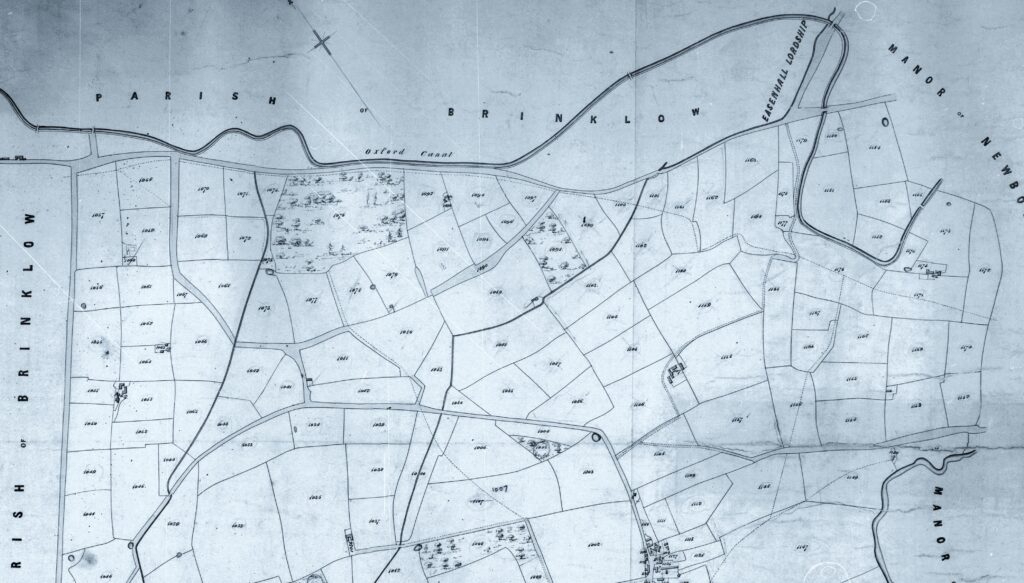
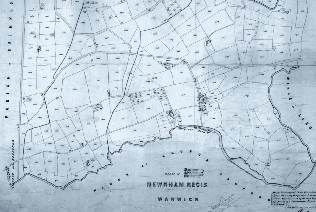
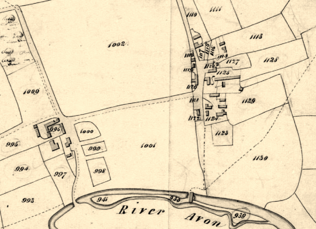
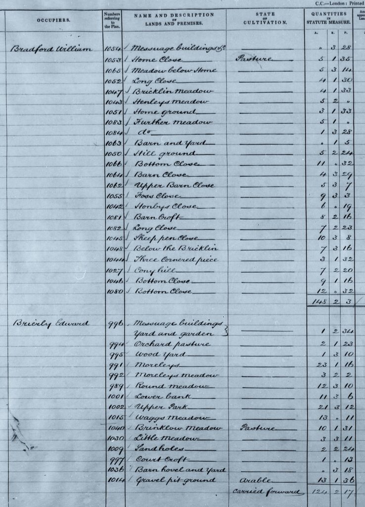
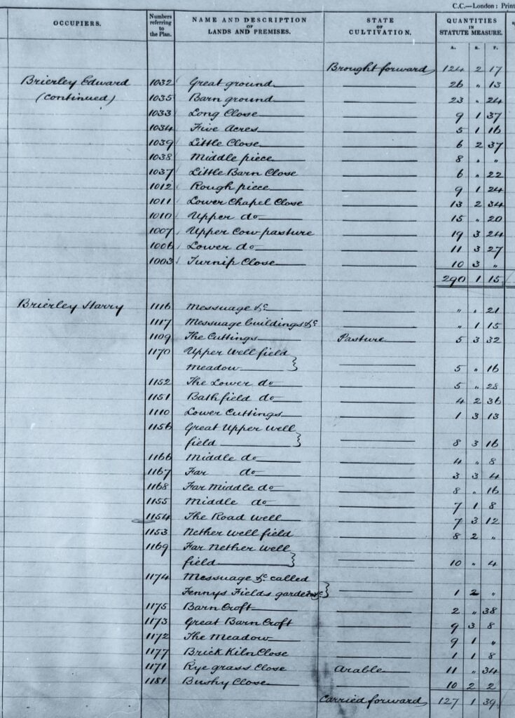
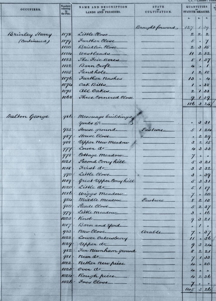
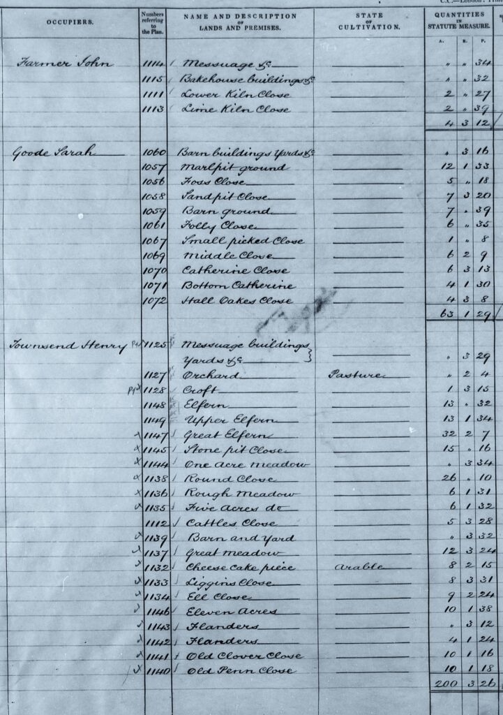
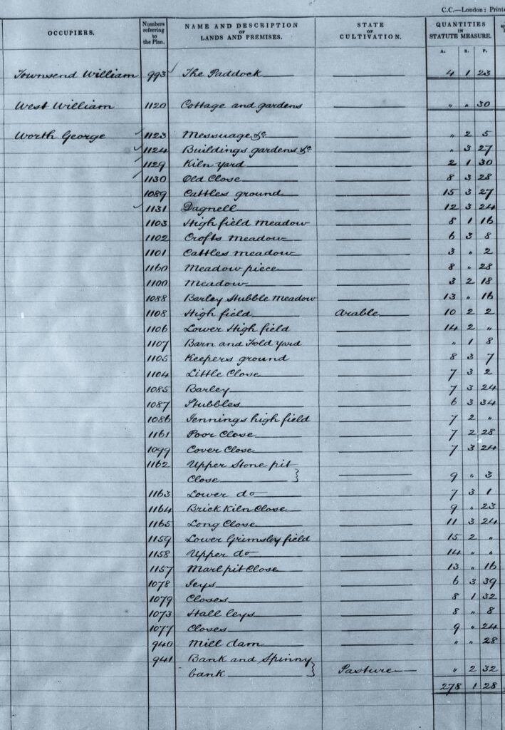
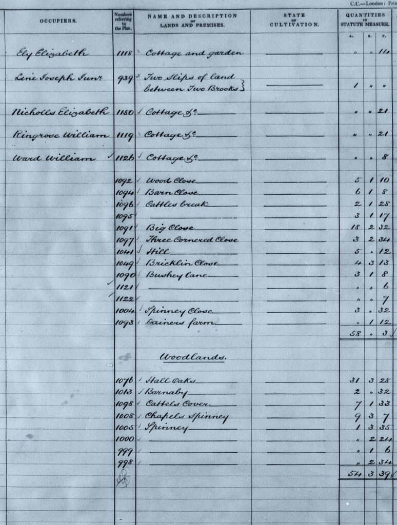
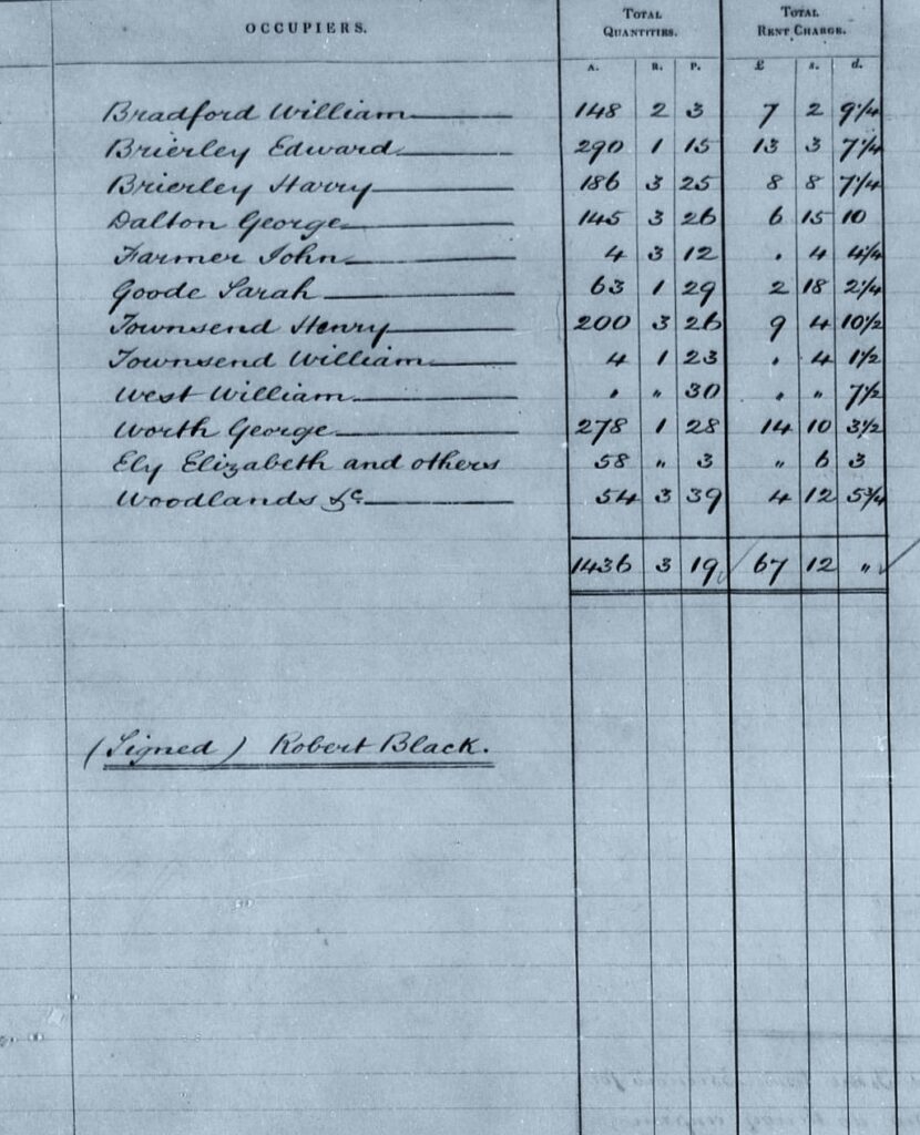
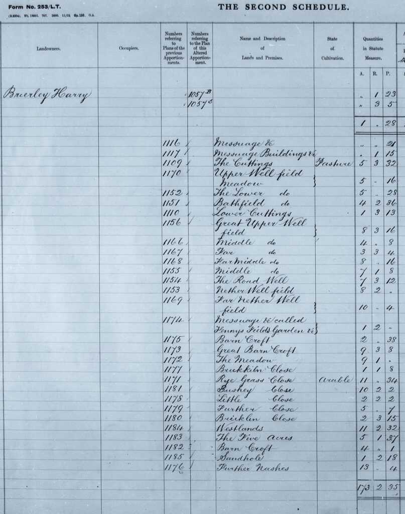
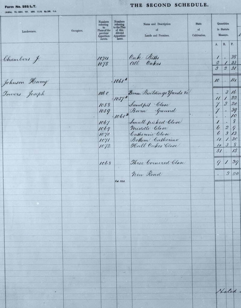
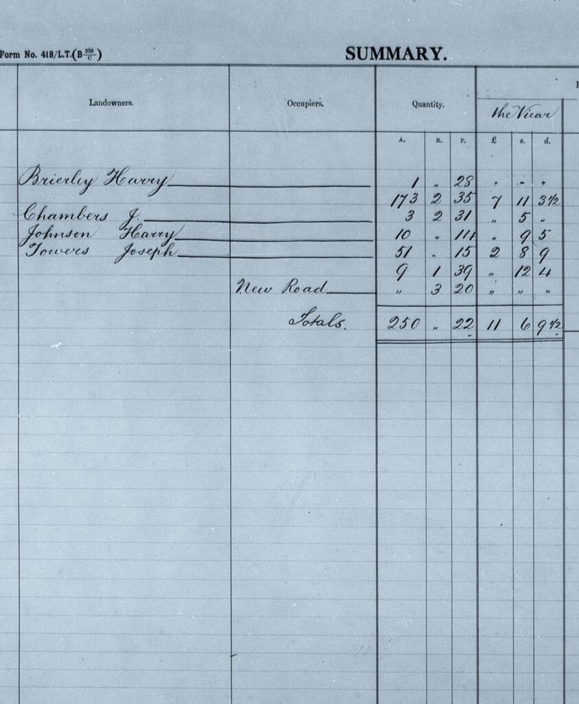
The parish map for Kings Newnham was divided down into distinct portions, where each field or property was defined and an owner identified. The number of tithes a particular person was responsible for dictated their annual tithe payment.
As Kings Newnham extends over a wide area, the map has been split into two sections, starting from the area abutting the Oxford Canal and working south towards Church Lawford. The third map shows more detail at the village level. The maps are in an east-west orientation, so the route of the canal at the top of the first map will help with orientation.
For a complete index to the tithe names and numbers see here.
