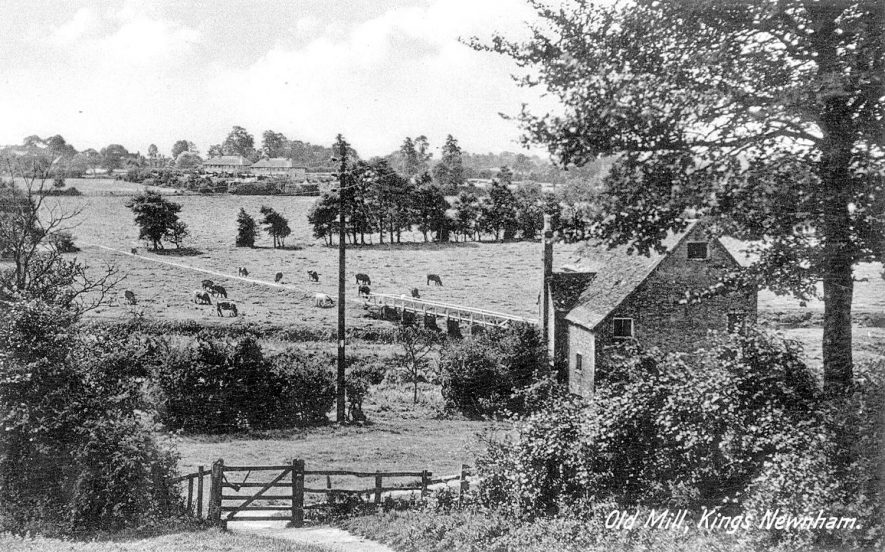
King’s Newnham Mill was a Water Powered Grist Mill. The first reference to a Mill linked to the River Avon in the local area was in the Domesday book – referenced here, with additional references throughout the centuries – as discussed here. The mill in its various forms operated through to the early 20th Century. It was used for grinding locally harvested corn and other cereal crops to produce flour.
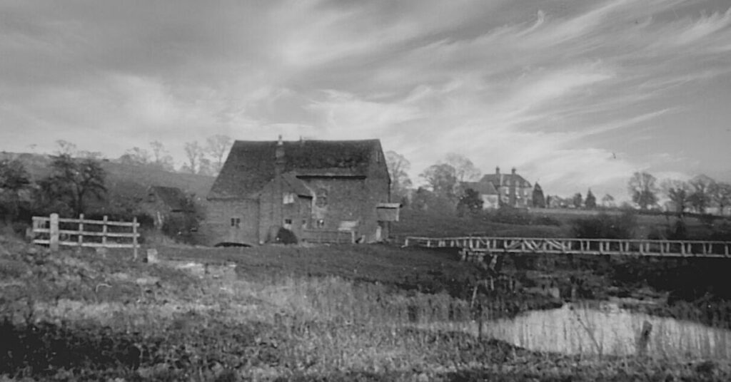
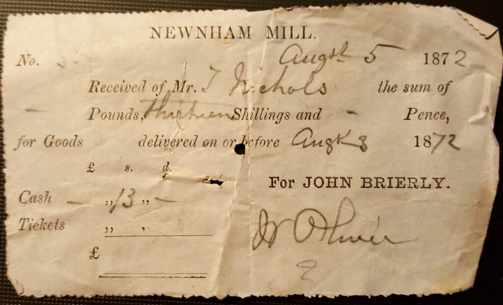
Although possibly closer to the Manor Farm in King’s Newnham, it was on the land of Kings Newnham Hall, and was thus part of the Brierly family operations for many of its latter decades. Although Edward, John and Harry Brierly were listed as a Miller in many of the Business Directories of the 19th and early 20th Centuries, they would have engaged a jobbing miller to operate the facility, with William Paul being one of the last known. An example of a Mill receipt that has survived 150 years is shown opposite.
Milling operations had ceased by the time of Newnham Hall being sold into the Cummins family in 1925.
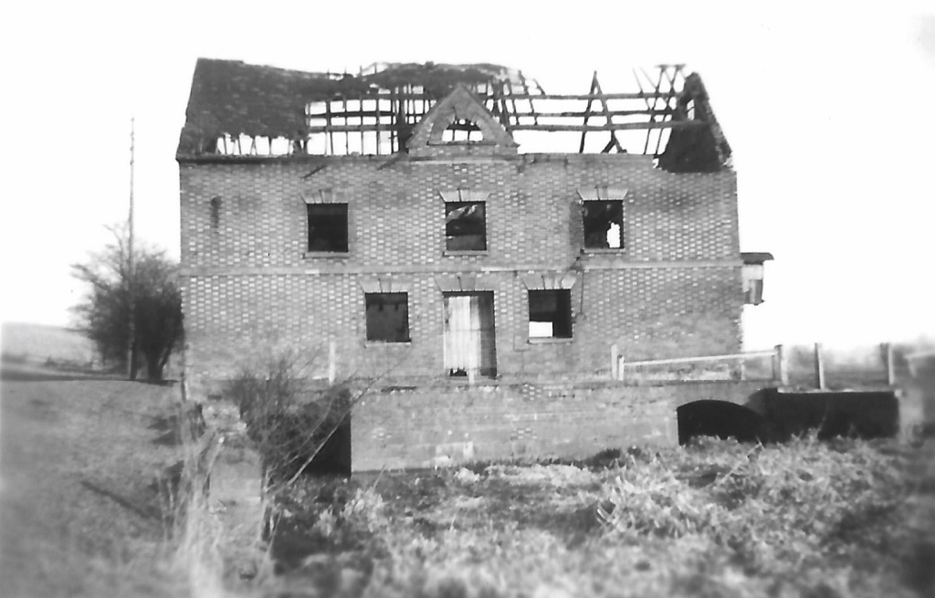
Shortly after the Second World War what remained of the Mill was destroyed in a fire, leaving a shell which was pulled down in following years.
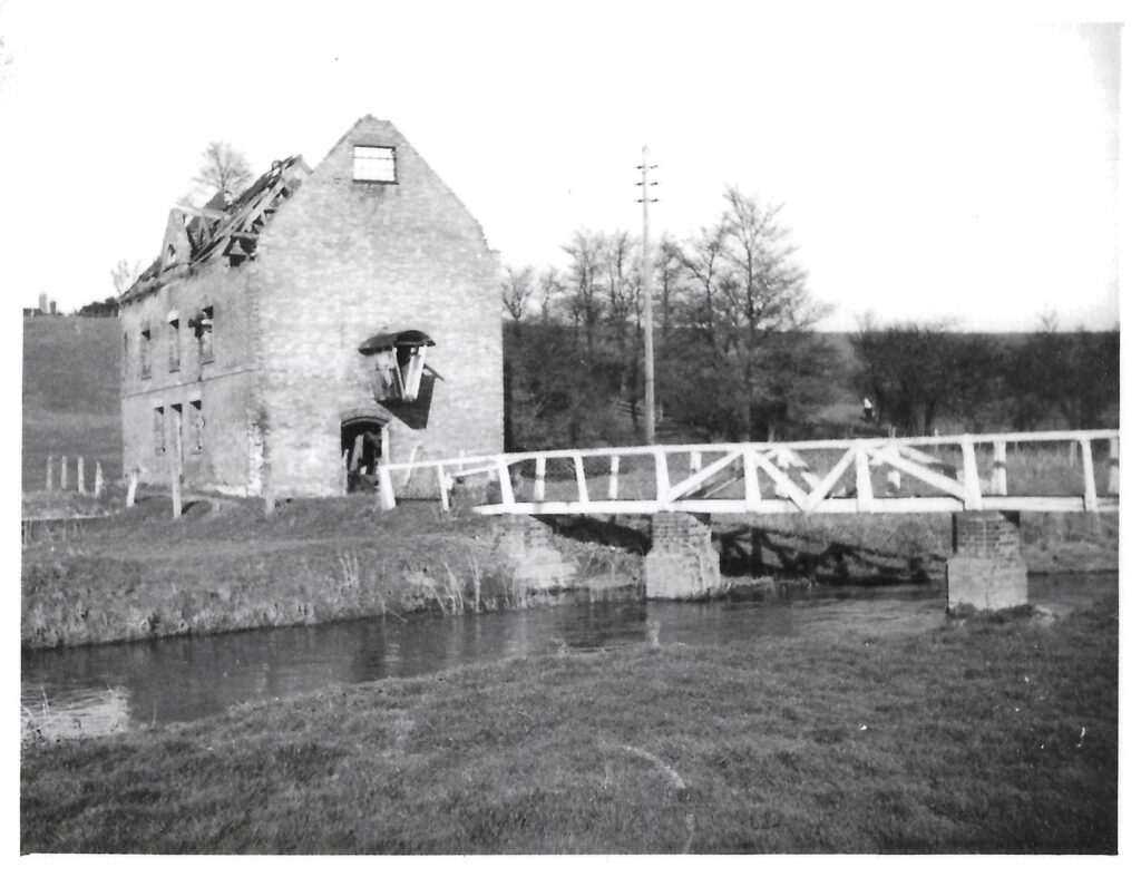
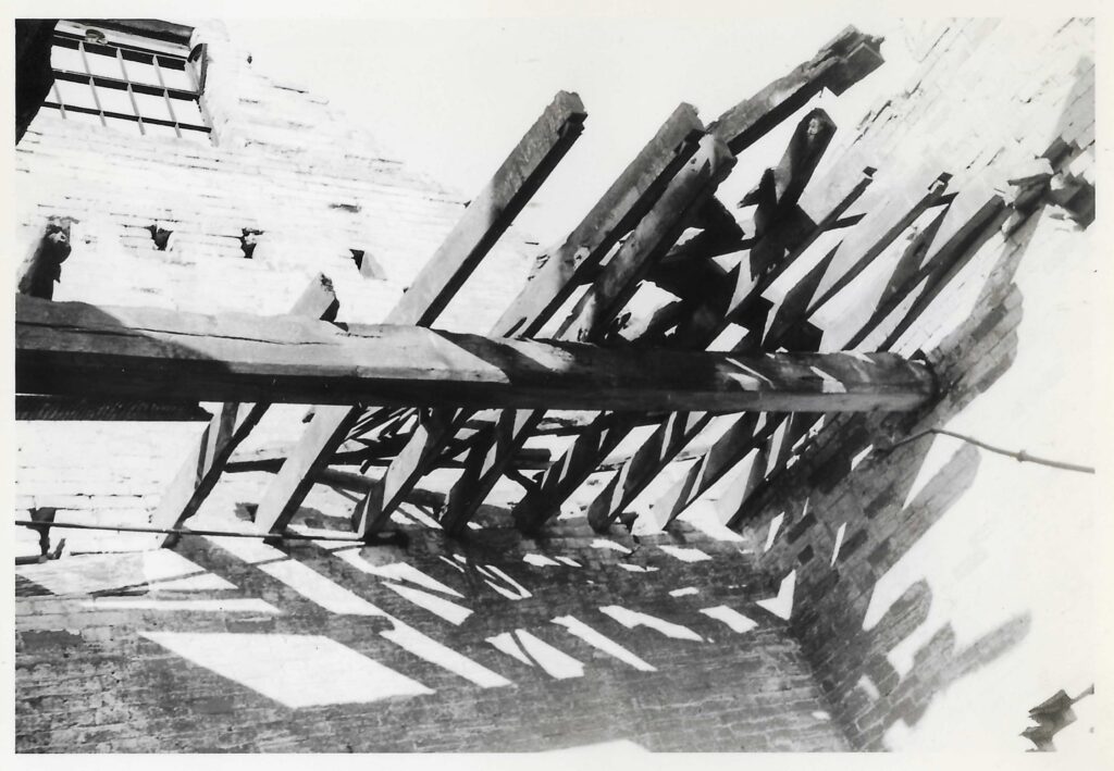
For details of the nearby Planks – the footbridge between Kings Newnham and Church Lawford see here.
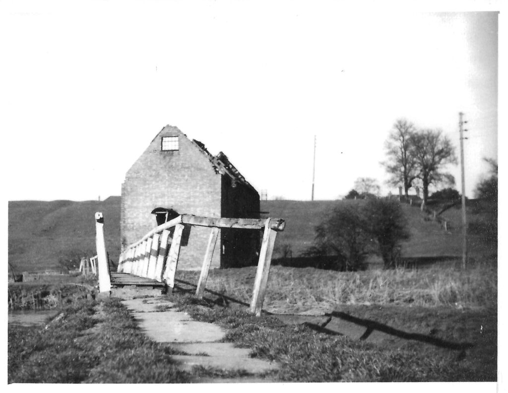
Research is needed into whether non-cereal products were once milled here (some other local mills offered other such services), and also to look at the possible presence of other mills in the parish.
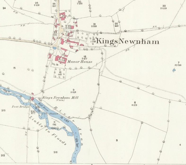
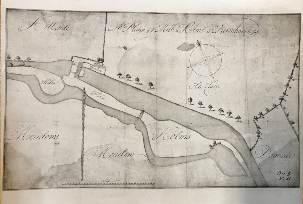
There is also an 18th Century plan of the Mill in existence, preserved in the set of maps retained by Lord John Scott and archived at Boughton House. The causeway and footbridge are clearly defined, but there appears to be more of a kink in the route over the mill channel and past the mill itself. Perhaps the main channel of the river is past the mill, with a sluice and separate channel for any excess water.
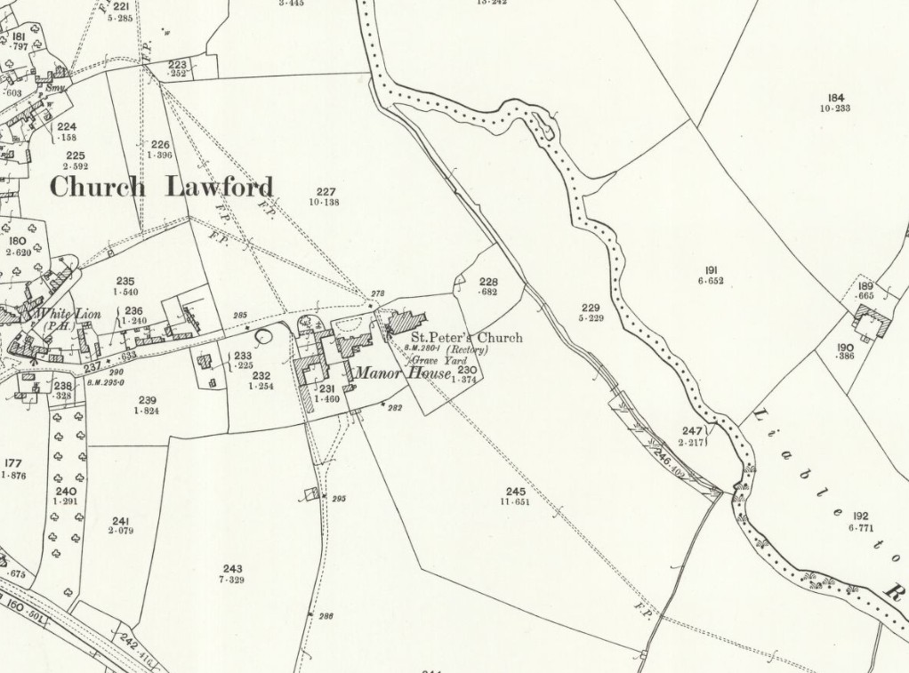
It is also known there was a channel in Church Lawford near the river, below the church, which may have been what was known as a mill leat, intended to produce sufficient flow to drive a mill wheel. As it was on the Church Lawford side of the river it might suggest there were plans to set up a mill there at one point, but no other evidence one was built or operated. The “watercourse” was clearly abandoned some years ago, and for some years during the twentieth century a single sleeper was used to cross it to get to the river below the church. There was a mill in Little Lawford and one in Marston near Wolston which may have offered local competition.
There also appears a strong possibility there was a wind powered mill in the Mount Pleasant area. In the 1720 Tithe Map for Church Lawford there are two tithe references to “Millers Ground” in the vicinity. Any Windmill must have been decommissioned prior to that date, as the Henry Beighton maps of 1725/9 do not show it. This may be the Mill described as being on Lawford Heath in earlier writings, as discussed here.
All of the above maps are reproduced with the permission of the National Library of Scotland. They were produced in 1886 and revised in 1903/5. These maps and more can be found via this link. There are different ways of navigating the maps there – the “Marker Pin” option is ideal for finding maps that cover a particular area, and the “Side By Side” viewer is excellent for comparing an old map with a current day view.
