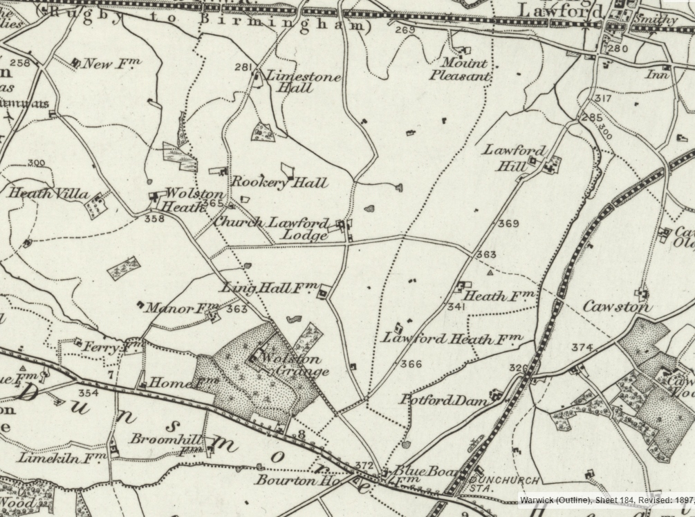
Middle Lane originally ran from the village centre in Church Lawford all the way to the south of the Parish – the map below is from 1900 and shows the complete road while Ling Hall Farm could be seen, prior to the Church Lawford RAF station being built during the Second World War.
Initially the road served mostly as an access road for the farms to the south of the village – Lodge Farm and Ling Hall Farm, with the road continuing to the Blue Boar area and the Holyhead / London Road, as well as linking to Dunchurch Railway Station.
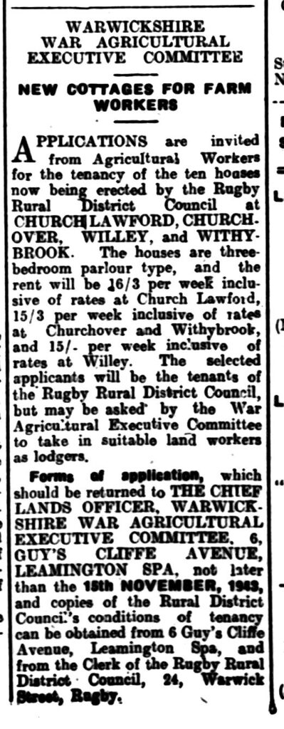
During the latter part of the Second World War period, Rugby Rural District Council started planning to create additional housing in rural areas, and one area chosen was in what was then known as Middle Lane, between the Rugby to Coventry road and the railway line. The first block of two houses were built towards the railway – and they were numbered 1 and 2 Pleasant View. The next group of 4 houses followed, complete with an alleyway in the middle to allow access to the rear of the middle two houses. The new Council Houses were three bedroomed, with a bathroom and flushing toilet, which compared well with the 1930s era council housing in the village. Like those there was also a generous garden area, front and back, and the provision of a washhouse was also a boon. Combining these facilities with the local community spirit meant that five of the six families listed in the 1960 directory were still living there 30 years later.
Following the Coronation of Queen Elizabeth II, the road was renamed Coronation Road, and later in the decade the houses were renumbered – 1,3,5,7,9 and 11 – although no even number houses were ever built on the western side of the road.

In earlier times the connection up to Church Lawford Lodge was an unmade road, and more direct access to that farm was via Ling Lane which ran east-west nearby, or south via Ling Hall farm. As can be seen from the map below, access to the south allowed connection to the Blue Boar area, including the nearby Dunchurch Railway Station. The Holyhead Road – now known as the A45 – passed near that point, and was the main London to Birmingham road at that point (remaining so until the M6 was linked to the M1 in 1971). There was also a link via Potford Dam to Cawston, which was the home of Lord Scott, Lord of the Manor in the 19th Century – and one of the few members of the Buccleuch line who lived locally. Similarly there was access to Dunchurch itself, a major staging point for 19th Century transport. The map indicates the presence of a long avenue of trees alongside the Holyhead Road – an initiative of an earlier Duke, known as “John the Planter” – detailed here.
A major change came during the Second World War period when RAF Church Lawford was established, with the loss of Ling Hall Farm – detailed here.
Then, as now, the lane was popular for walks and cycling – the walk “around the top” being up middle lane and back down Limestone Lane being especially popular. There was a chance to watch the trains too, as the middle lane bridge was only about 3 feet high. When the line was electrified the section of the bridge over the tracks was raised to about 6 feet, but that still left lengths to either side at the original height for many years. The two cattle grids were still there – much easier to walk across in the sixties and seventies with their flat sections, and the lodge cottages seemed more isolated at the bottom of the hill. The vehicles of those times were considerably narrower too, and only the local farmer on his tractor and trailer would take up most of the road – with the only time to avoid being when the big combine harvester was being moved.
During the late 1960s / early 1970s there was a certain amount of upheaval to the route when the National Gas Pipeline was laid across a section near Billingham’s Barn – the pipeline runs across the country from Norfolk to the Gower Peninsula (people will have seen the Gas Station near the railway on Rugby Road).
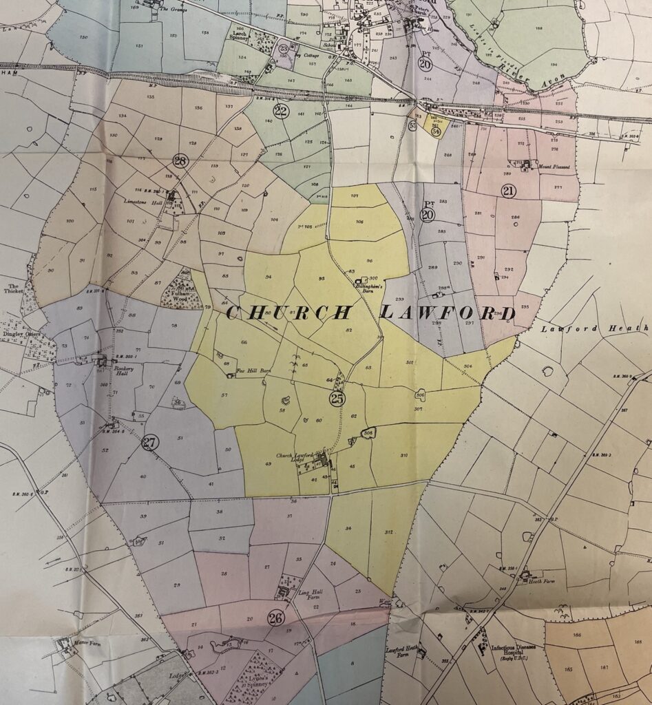
The second map below is the 1918 auction village map showing Middle Lane and indicating the adjacent area of Glebe Land towards the end nearest the village (which lacks shading), some of which was sold ahead of the Pleasant View houses being built by Rugby District Council. For the key to the colour coded plots see the lot numbers here.


