Over the centuries there have been a number of reorganisations of the various subdivisions of the country, and of each of those subdivisions themselves. This page attempts to explore how and when the boundaries of the two villages were defined, and how they fit into the district and county structure.
The starting point for such a review is the “Ceremonial County” of Warwickshire, an entity that has existed since the 11th Century when it was defined as a division of the kingdom of Mercia.
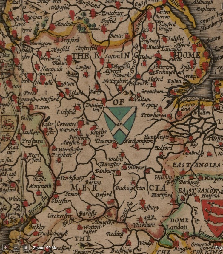
The boundary was well-defined for nine centuries, with just a few tweaks to align places on the border either inside or outside of the county. In 1974 the formal definition of the Ceremonial County was established, alongside the new West Midlands County that was formed to extract a large chunk of the western and central parts from the county of Warwickshire. The remainder of this discussion will refer to the original county boundaries established for those nine centuries.
In the 11th Century Domesday book, Warwickshire was divided into ten Hundreds – the main subdivisions of a county.
In the thirteenth century the Warwickshire hundreds were grouped differently, with the county now defined into four Hundreds – the Knightlow Hundred was defined alongside Barlichway, Kington and Hemlingford. Within each Hundred there were a number of Divisions, and each of those divisions consisted of a number of parishes. The parishes of Church Lawford and Newnham Regis were in the Rugby division of the Knightlow Hundred throughout.
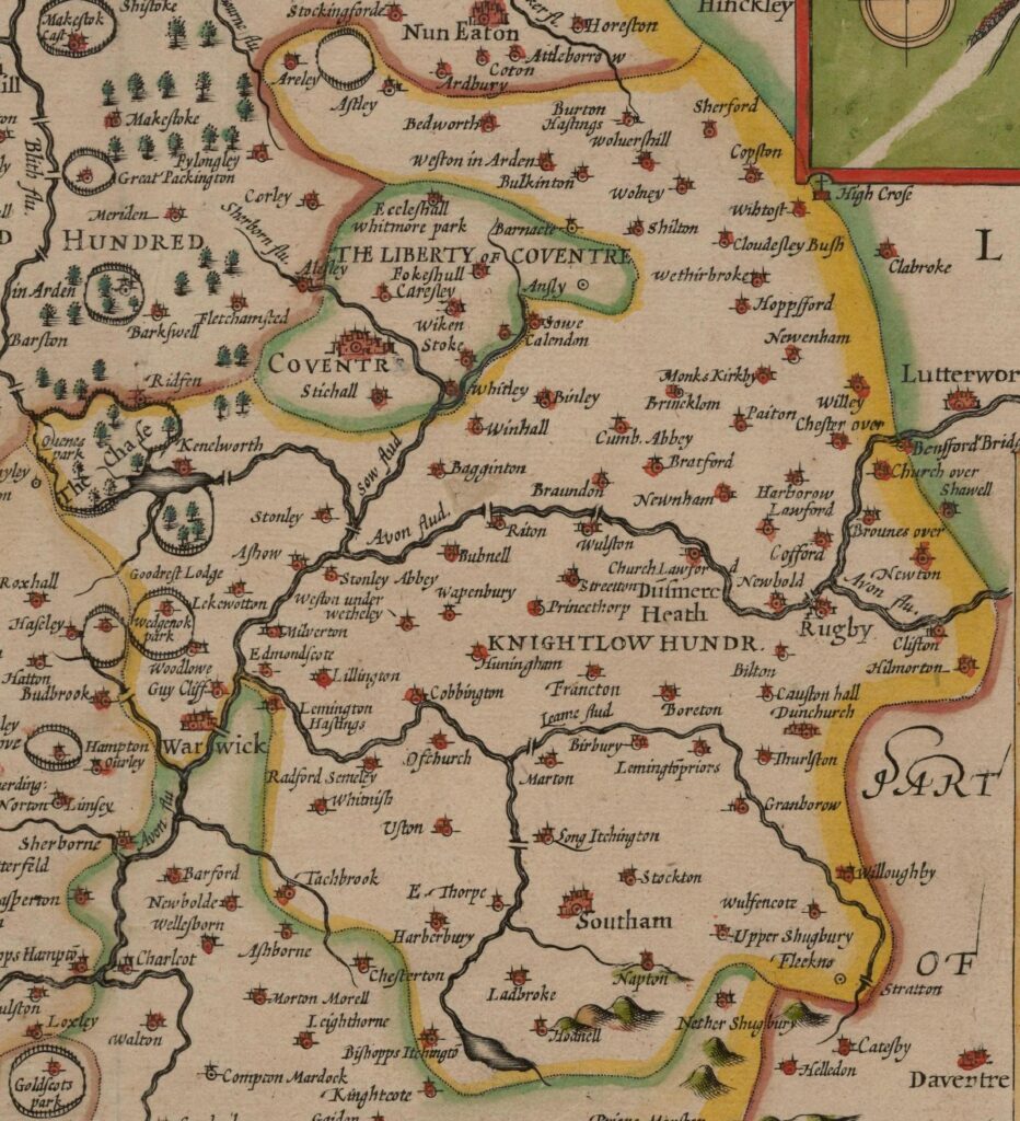
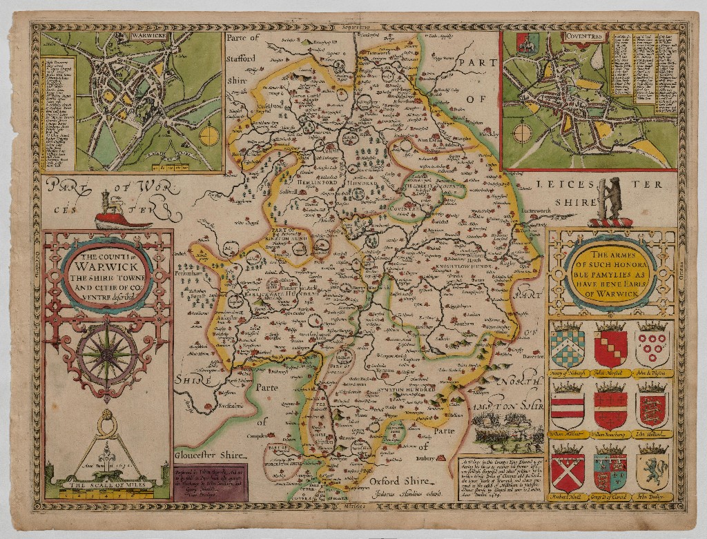
In the sixteenth century there were various studies made by eminent historians, both of the country, and of the county. John Speed produced invaluable maps in his “Theatre of Great Britain”, and William Camden looked at the history and topography of Great Britain in extreme detail in his “Britannia”, such that he became known as the father of English History (see here for his entry on Kings Newnham). Sir William Dugdale added further details of the various parts of the county in 1656. All these component parts were then combined by William West to produce the History of Warwickshire in 1830, with additional early nineteenth century directory updates added by Adam Murray of the Board of Agriculture.
Some of the earliest maps were created by John Ogilby, and published around 1675 in a publication also entitled “Britannia” – this was a collection of strip maps for routes across the country, one of which passed between Rugby and Coventry. There was also a more compact version produced by John Senex in 1719, complete with updated maps. See here for more details and maps.
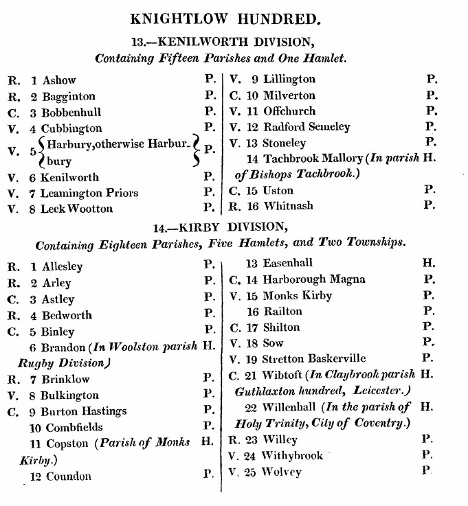
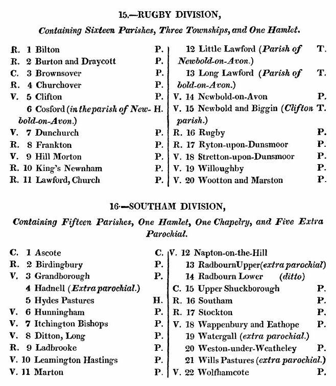
The breakdown of the Knightlow Hundred into Districts and Parishes as of 1830 is shown below. Note that the abbreviation R indicates a Rectory – i.e. where the living offered includes the tithe payments. The letters V and C refer to the those with the alternative Vicarage and Chapelries. In the right hand column the letter P indicates a Parish, H indicates a Hamlet.
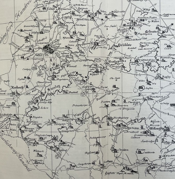
In 1725 a survey was made of Warwickshire by Henry Beighton, and the resultant maps were published in 1729. More detail from this map can be seen on a separate page here.
