Although the early detailed Manor Maps, as discussed here, provided the Lord of the Manor with a view of his properties, there became a need for detailed maps of the whole country for defence purposes. The Ordnance Survey provided these maps, with a major mapping project throughout the early 19th Century.
1830s Map of the Parishes
The parish layout was defined well in the documents that accompany the 1918 sale, linked below, but an earlier 1831 map produced by the Ordnance Survey shows the layout before the railway arrived – it arrived just a short while afterwards.
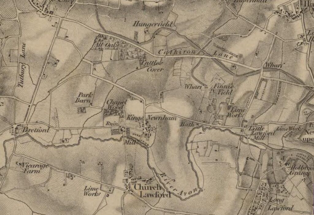
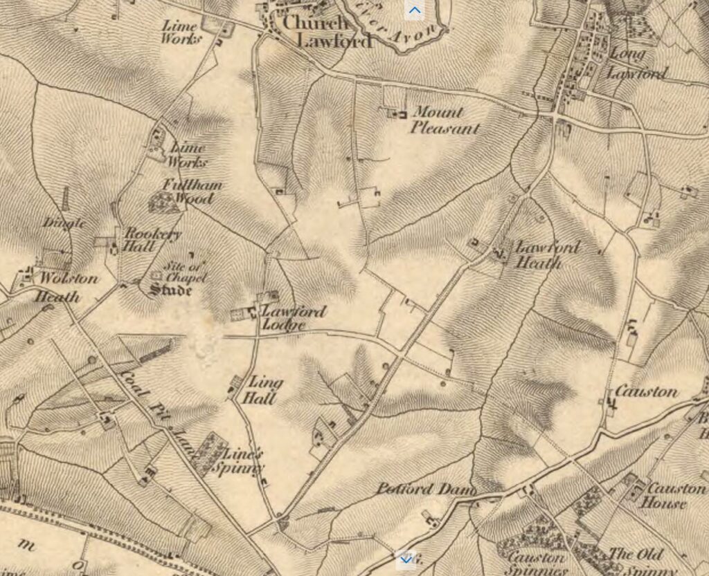
The above two maps are from 1831, predating both the Birmingham to London railway line and motorised transport in general.
As well as showing the layout without the railway line, the maps highlight a number of features which aren’t readily seen in more recent times. The Lime Works in the Limestone Lane area are mapped – which gave both the Hall and the lane their names. The more southerly works are well known, but the works shown near the Coventry to Rugby Road are less well understood.
The village centre of Church Lawford looks even smaller than shown on later 19th Century maps – smaller indeed than King’s Newnham. The appears little housing north of the village green, with Smithy Lane not established.
In King’s Newnham the wider parish shows the Baths and the Lime Works, as well as the arm of the canal that reached Fennis Fields (shown as Finnis Fields).
The routes available to reach the outlying farms in Church Lawford are somewhat different, notably to Lawford Lodge, where the main access seems to be from the Blue Boar area via Ling Hall (although there is a smudge on the original map which adds a little confusion). There is also detail of the site of a chapel near Rookery Hall, which requires further investigation.
The above maps are part of a series which can be download from the National Library of Australia, and which are documented on the Charles Close Society website.
1849/50 Tithe Maps
The next maps to be considered are the 1849/50 Tithe Maps, which are discussed in more detail on their respective pages.
1850 Church Lawford Tithe Maps
1850 King’s Newnham Tithe Maps
A more detailed review of these maps, linking people to the actual plots of land referenced in the Tithe documents is underway – the latest version is here.
The more detailed Tithe review also includes mapping of village cottages to named families – that specific review is here.

1860 OS Maps
The following maps are from the 1860s – see below them for a discussion of what can be gleaned from them.
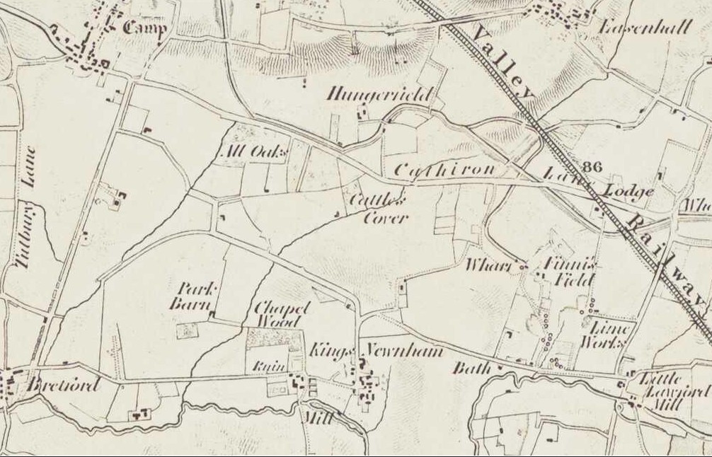
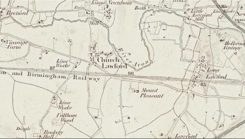

The above three maps are from the early days of the Ordnance Survey produced in the 1860s, but unlike the 1830 maps above they show the three railway lines relating to the two parishes.
The above maps are part of a series which can be download from the National Library of New Zealand, and which are documented on the Charles Close Society website.
1903/5 Overview Maps
Three overview OS maps surveyed in the nineteenth century, with updates early in the twentieth, running from North to South are as follows
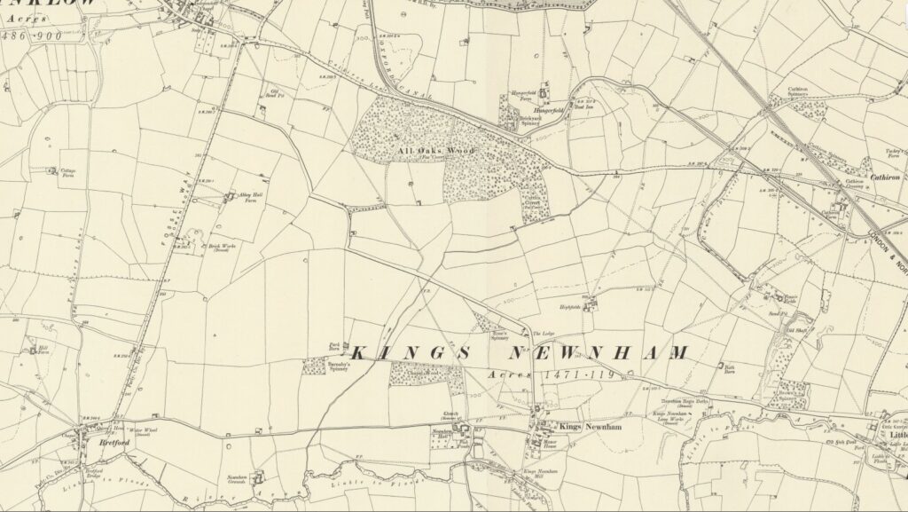
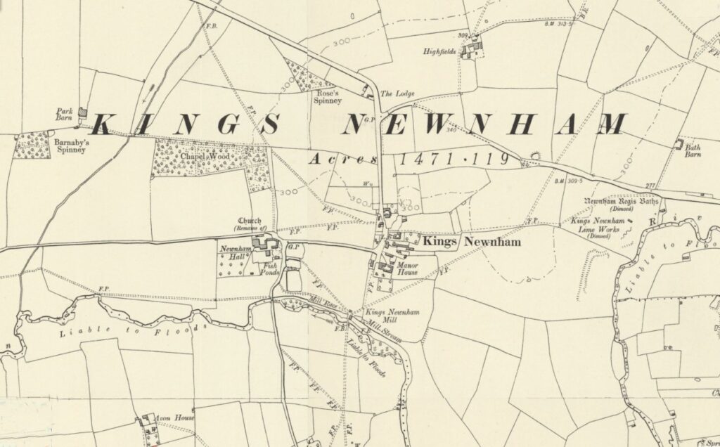
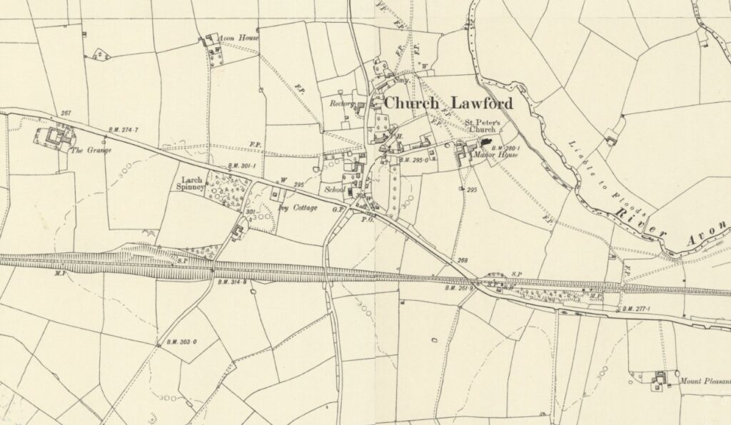
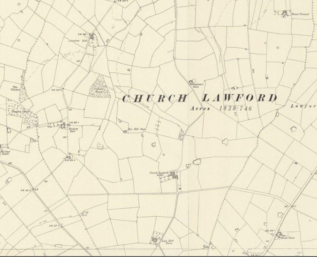
The above maps are reproduced with the permission of the National Library of Scotland. They were produced in 1886 and revised in 1903/5. These maps and more can be found via this link.
1903/5 Detailed Ordnance Survey Maps
As mentioned above, an alternative way of looking a a wide range of Village Maps is to use the National Library of Scotland Maps at https://maps.nls.uk/index.html There is an option to compare old maps with a current map in a “side by side viewer”. The old maps can also be located directly on the site – although unfortunately for the interesting 1903/05 25 Inches to the Mile maps, the two villages are on a corner join – meaning a need to look at four maps to look at the central areas – although this does make it easier to see the outlying parishes. The south portion of the Church Lawford parish is then on a separate map.
These maps are accessed by the following links (North to South, West to East)
To pick out other maps on the extremities, or maps from different dates use the link here
1918 Sale Maps
As part of the Auction of land and properties in 1918, various colour-coded maps were created. This allows a view of the overall Parish, the outlying farms, the Village Centre of Church Lawford and King’s Newnham Village, using a number of maps.
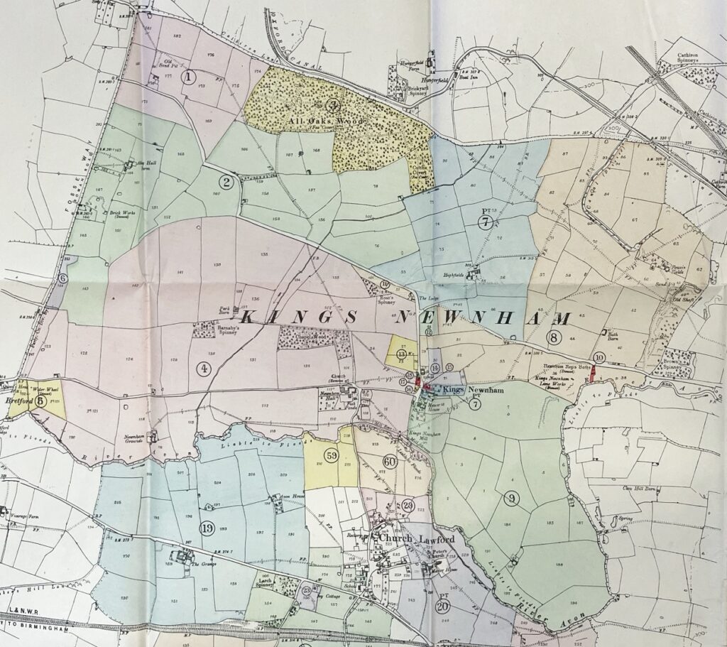
This map shows the extent of the King’s Newnham Parish area in the early twentieth century. The references and colour coding are explained in the narratives about the village auction of 1918. By this date both the limeworks and the King’s Newnham baths were disused, although King’s Newnham Mill was still operational.
King’s Newnham Parish Auction Link
Cottage Numbering in the two villages is discussed in this link.
The various streets in the two villages are reviewed, complete with pictures, in this link.
The farms in the two villages are reviewed in this link, and the various listed buildings are reviewed here.
Outlying Farms
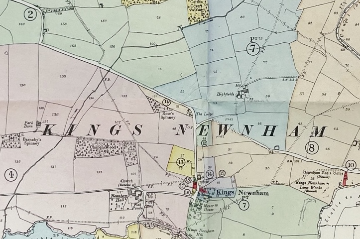
This map shows the details of the King’s Newnham village area in the early twentieth century. The references and colour coding are explained in the narratives about the village auction of 1918.
Church Lawford Parish
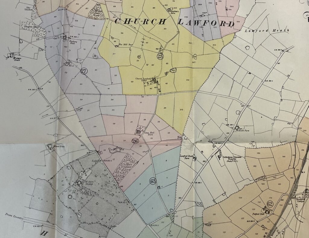
This map shows the extent of the remainder of the Church Lawford Parish area in the early twentieth century, that is not shown in the map above referencing King’s Newnham Parish. The references and colour coding are explained in the narratives about the village auction of 1918.
Church Lawford Parish Auction Link
The loss of Ling Hall Farm during the Second World War is discussed here.
The farms in the two villages are reviewed in this link.
Church Lawford Village
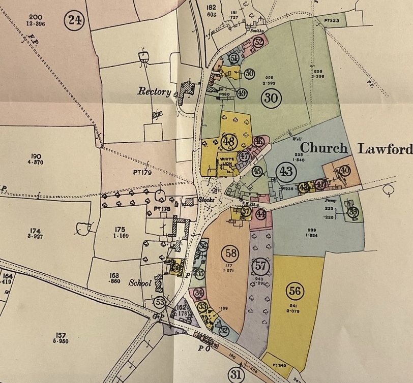
This map shows the extent of the Church Lawford village area in the early twentieth century. The references and colour coding are explained in the narratives about the auction. At this stage the village housing only extended north as far as Smithy Lane, with no houses south of the main Coventry to Rugby Road. The streets were not officially named at this stage, although were typically called School Lane, Church Lane, Smithy Lane, Little End and King’s Newnham Lane, along with Rugby Road and Coventry Road either side of the Triangle.
Church Lawford Village Auction Link
Discussions about the changes in the village layout and street naming during the twentieth century are available via this link.
Cottage Numbering in the two villages is discussed in this link.
The various streets in the two villages are reviewed, complete with pictures, in this link.
The farms in the two villages are reviewed in this link, and the various listed buildings are reviewed here.
Further old maps, at a County level to show the structure of the Knightlow Hundred, plus some more historic mapping from the 16th and 17th centuries can be found here.
An alternative way of looking at the changes in both villages is discussed on the pages detailed a sequence of maps for particular areas – details here.
