As part of the Auction of land and properties in 1918, various colour-coded maps were created. This allows a view of the overall Parish, the outlying farms, the Village Centre of Church Lawford and King’s Newnham Village, using a number of maps.
- King’s Newnham
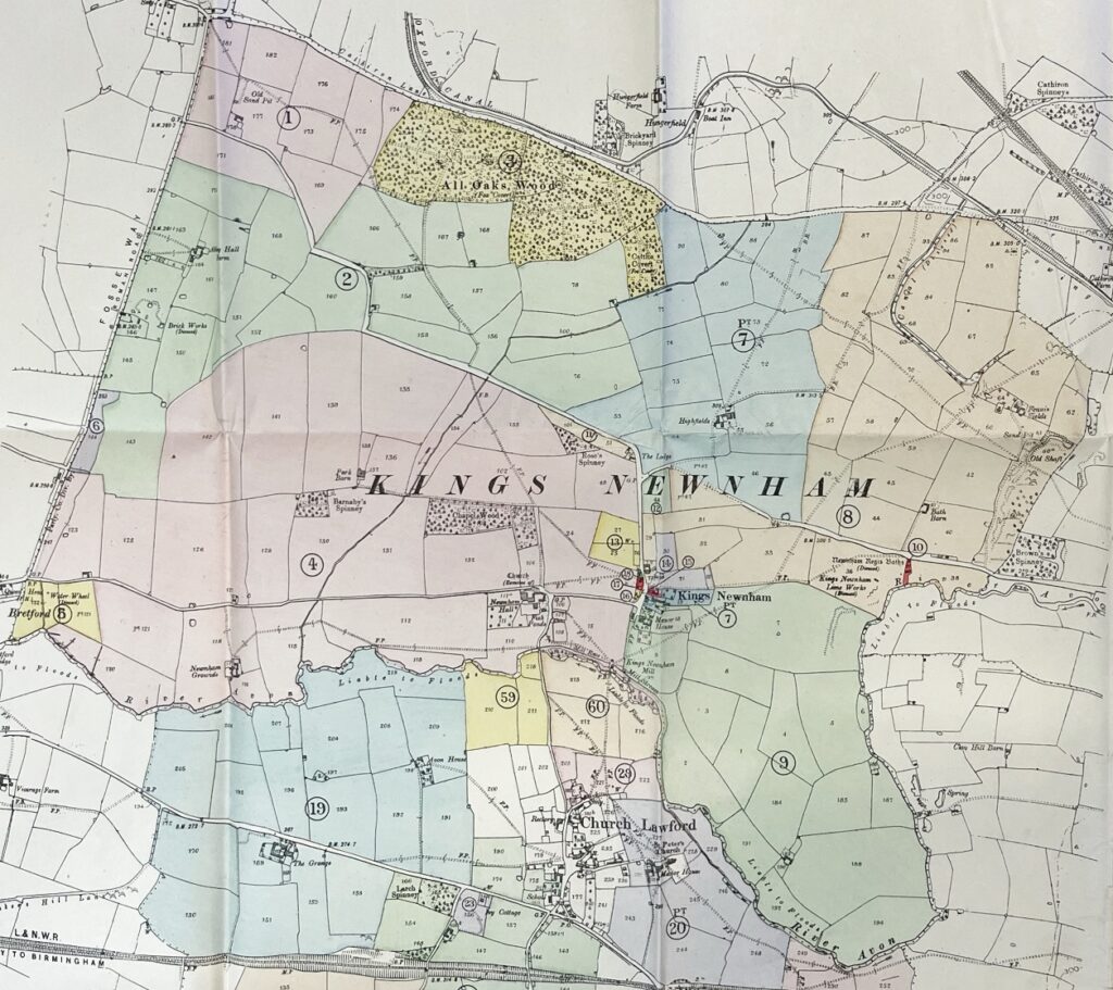
This map shows the extent of the King’s Newnham Parish area in the early twentieth century. The references and colour coding are explained in the narratives about the village auction of 1918. By this date both the limeworks and the King’s Newnham baths were disused, although King’s Newnham Mill was still operational.
King’s Newnham Parish Auction Link
Cottage Numbering in the two villages is discussed in this link.
The various streets in the two villages are reviewed, complete with pictures, in this link.
The farms in the two villages are reviewed in this link, and the various listed buildings are reviewed here.
2. Outlying Farms
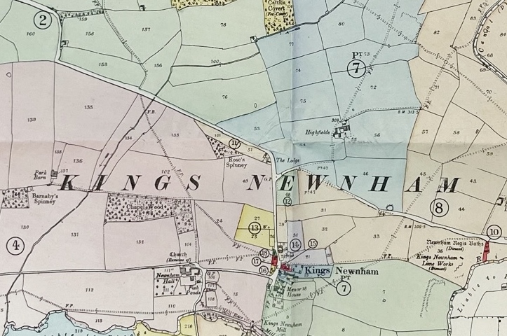
This map shows the details of the King’s Newnham village area in the early twentieth century. The references and colour coding are explained in the narratives about the village auction of 1918.
King’s Newnham Parish Auction Link
3. Church Lawford Parish
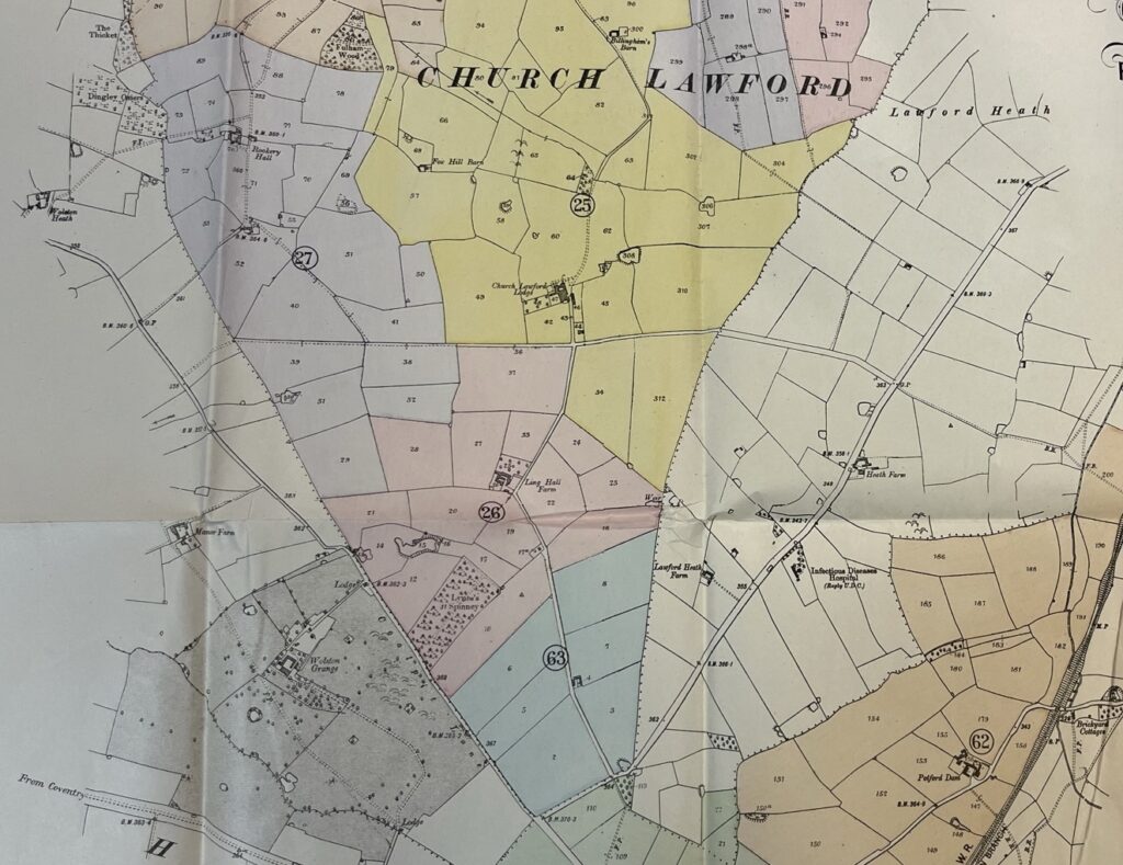
This map shows the extent of the remainder of the Church Lawford Parish area in the early twentieth century, that is not shown in the map above referencing King’s Newnham Parish. The references and colour coding are explained in the narratives about the village auction of 1918.
Church Lawford Parish Auction Link
The loss of Ling Hall Farm during the Second World War is discussed here.
The farms in the two villages are reviewed in this link.
4. Church Lawford Village
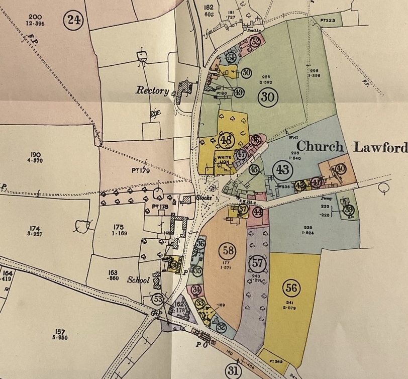
This map shows the extent of the Church Lawford village area in the early twentieth century. The references and colour coding are explained in the narratives about the auction. At this stage the village housing only extended north as far as Smithy Lane, with no houses south of the main Coventry to Rugby Road. The streets were not officially named at this stage, although were typically called School Lane, Church Lane, Smithy Lane, Little End and King’s Newnham Lane, along with Rugby Road and Coventry Road either side of the Triangle.
Church Lawford Village Auction Link
Discussions about the changes in the village layout and street naming during the twentieth century are available via this link.
Cottage Numbering in the two villages is discussed in this link.
The various streets in the two villages are reviewed, complete with pictures, in this link.
The farms in the two villages are reviewed in this link, and the various listed buildings are reviewed here.
Further old maps, at a County level to show the structure of the Knightlow Hundred, plus some more historic mapping from the 16th and 17th centuries can be found here.
