Prior to the arrival of the railway in the middle of the nineteenth century, and before the Ordnance Survey started to produce their detailed and precise maps, the local plans of the area had quite a different look and feel.
One such map was produced by John Cary, and published around 1806, and this article will provide a brief summary of local places that have changed in the following two centuries – and in some cases have completely disappeared.
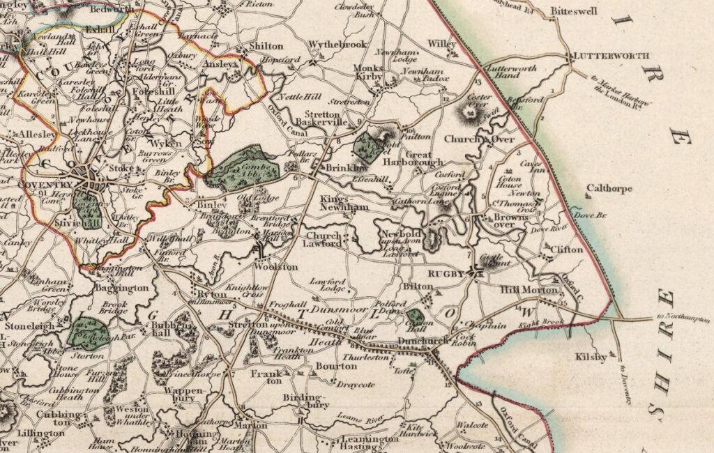
A. Infrastructure
Before the railway – and well before any motorised transport – there was a reasonable network of roads, In terms of “long distance” roads, two old roman roads passed near the two villages- Watling Street and the Fosse Way. The Watling Street ran from Dover, via London, to Wroxeter in Shropshire (once the fourth largest settlement in Roman Britain).