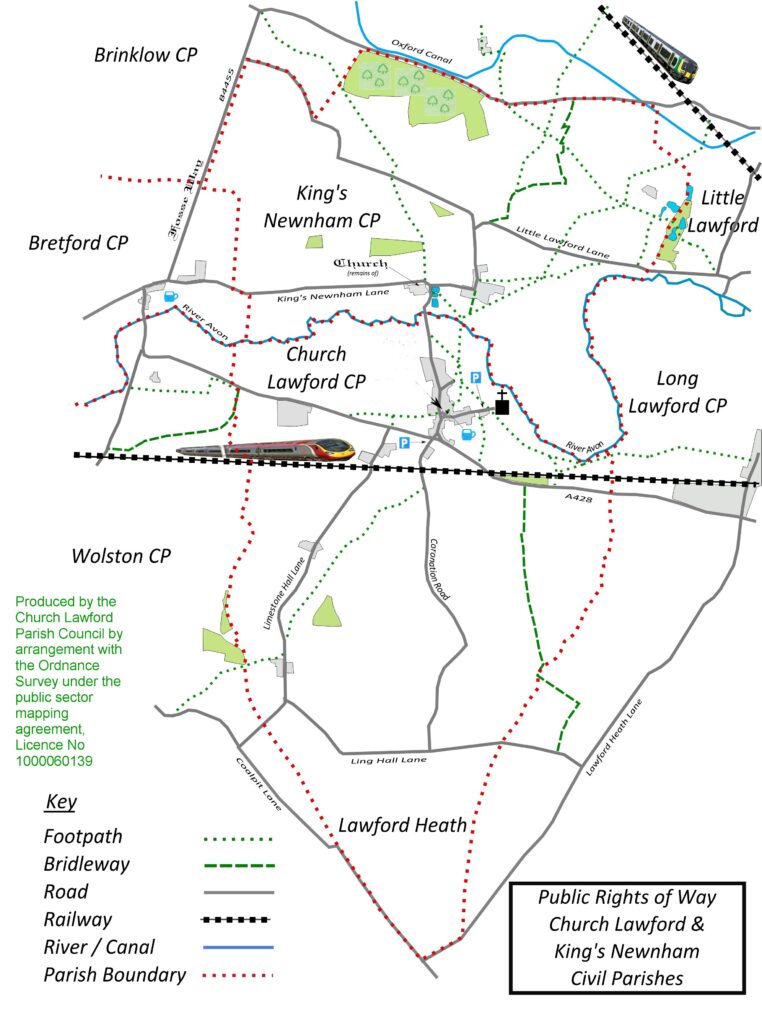
This section outlines the current parish layout, using the map displayed on the Village Notice Board. More specific details on the various streets and lanes in the Parish can be found here, and further old maps, are highlighted separately here.

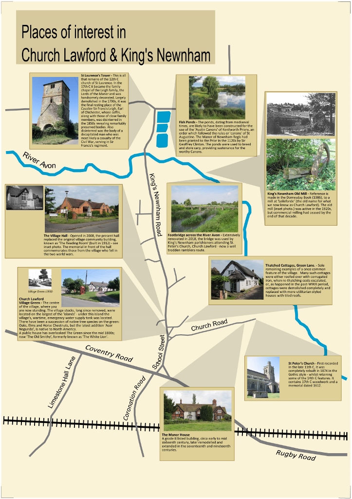
A more contemporary view can be seen on the Village Information Board, sited on the village green, This map dates from around the start of the 21st century and also shows village footpaths as they were at that time. A separate board highlights items for any visitors to the village (see below). Note that this shows the two civil parishes of Church Lawford and Kings Newnham, along with the surrounding parishes, which may differ slightly from the classic ecclesiastical parishes
This information board was displayed in the village in the spring of 2019.
More details on the various “Places of Interest” can be found via the following links

One alternative way of looking at the Village Map is to use the National Library of Scotland Maps at https://maps.nls.uk/index.html There is an option to compare old maps with a current map in a “side by side viewer”. The old maps can also be located directly on the site – although unfortunately for the interesting 1903/05 25 Inches to the Mile maps, the two villages are on a corner join – meaning a need to look at four maps to look at the central areas – although this does make it easier to see the outlying parishes. The south portion of the Church Lawford parish is then on a separate map.
These maps are accessed by the following links (North to South, West to East)
To pick out other maps on the extremities, or maps from different dates use the link here
A selection of old maps from the 18th and 19th Centuries can be found here.
Sequences of maps for a specific section of the two villages using the NLS Maps mentioned above can be found via this link.
