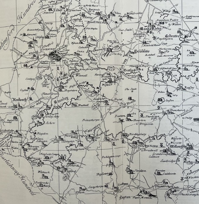
In 1725 Henry Beighton carried out a survey of Warwickshire, and the resultant maps were published in 1729, including as an update to the “Antiquities of Warwickshire” work written by William Dugdale.

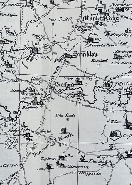
The key to these maps indicates that the churches are drawn to their true shape and of four sizes as they bear proportion to each other. This suggests Kings Newnham Church was of a similar proportion to that of Church Lawford, and also similar to Brinklow Church.

Other information that can be gleaned from this map is the presence of the Stude on Dunsmore Heath, which is referenced by Dugdale (see here). Windmills are shown, including the Toft Windmill, so any windmill that might have been in Church Lawford was clearly decommissioned before this date.
