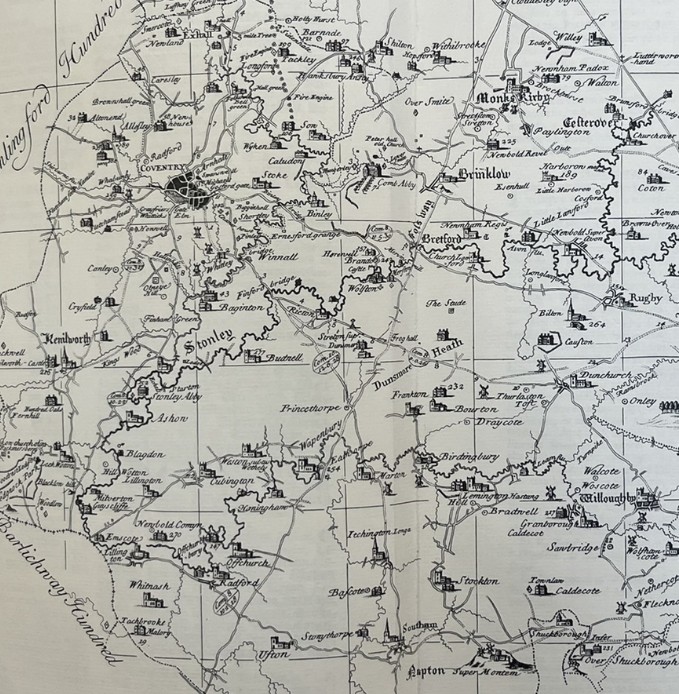
Early Mapping at a local level came via the Lord of the Manor. The Manor Map would show the breakdown of the area at a field level. Further old maps, at a County level to show the structure of the Knightlow Hundred, plus some more historic mapping from the 16th and 17th centuries can be found here. The original Ordnance Survey Maps from the 19th Century can be found here.
An alternative way of looking at the changes in both villages is discussed on the pages detailed a sequence of maps for particular areas – details here.
1720 Map of Church Lawford
Lord John Scott assembled a collection of tithe maps from around 1720 for the various parts of the manor that included the two villages, as well as other villages in the Dunchurch area. These maps included a detailed village map of Church Lawford, as well as a field level map for each parish. These maps are held in the Warwick Records Centre. The compass at the top of the map shows the orientation (the heraldic fleur-de-lis symbol indicates north). The maps are looked at in more detail on the pages review the 1720 tithe information – for Church Lawford see here and for King’s Newnham see here.
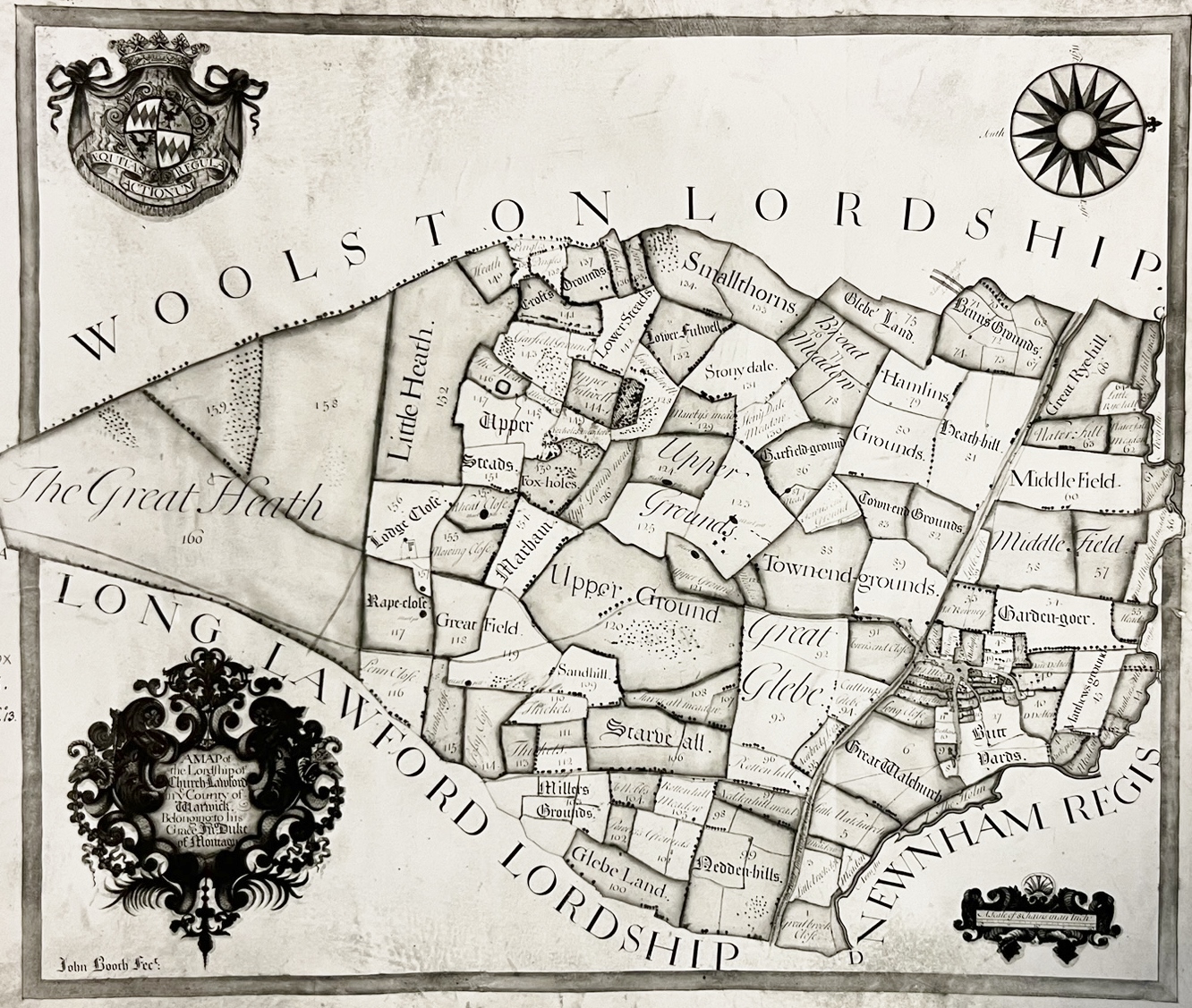
1720 Map of King’s Newnham
The equivalent map for the King’s Newnham section.
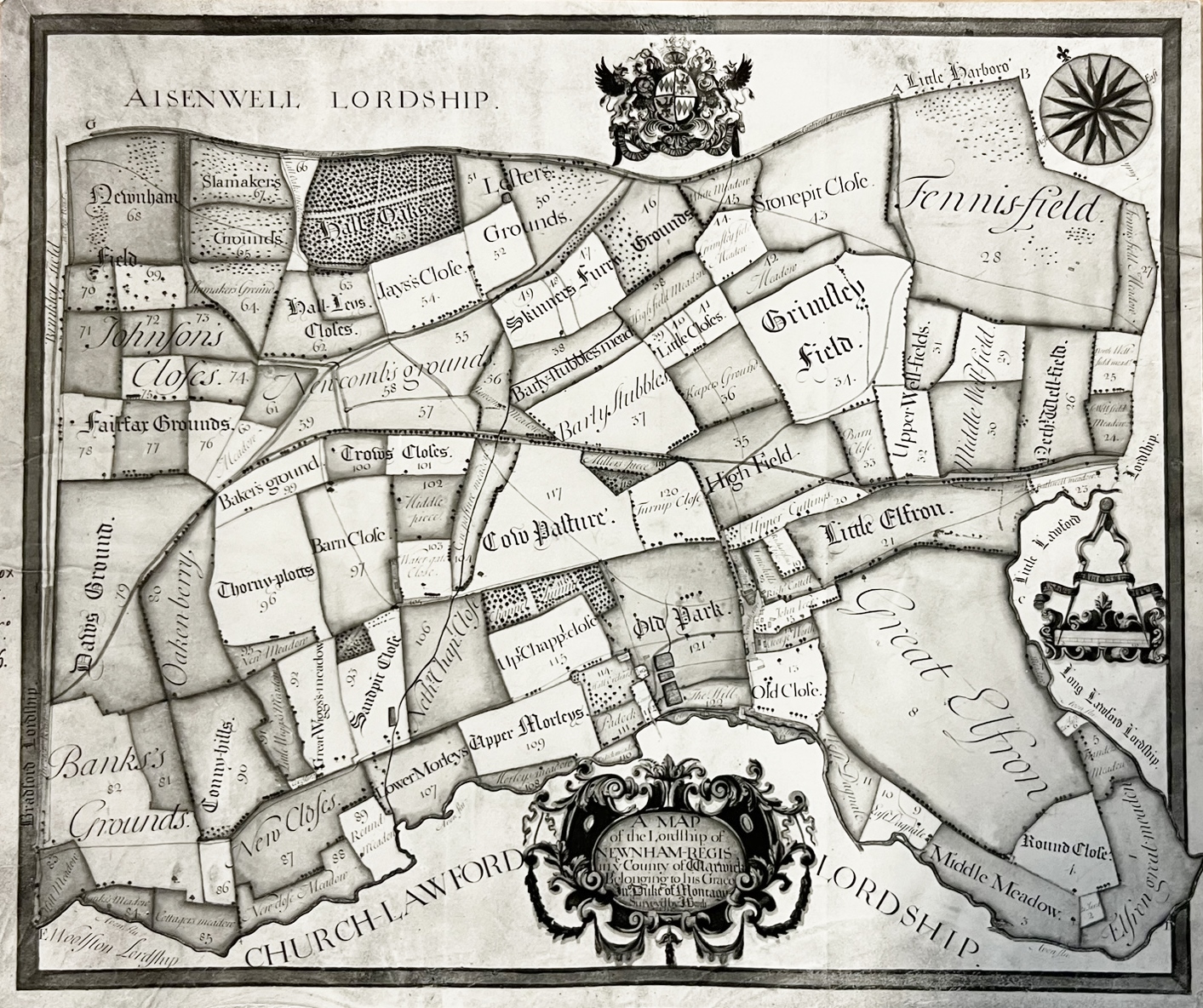
Manor Map – Church Lawford Village 18th Century
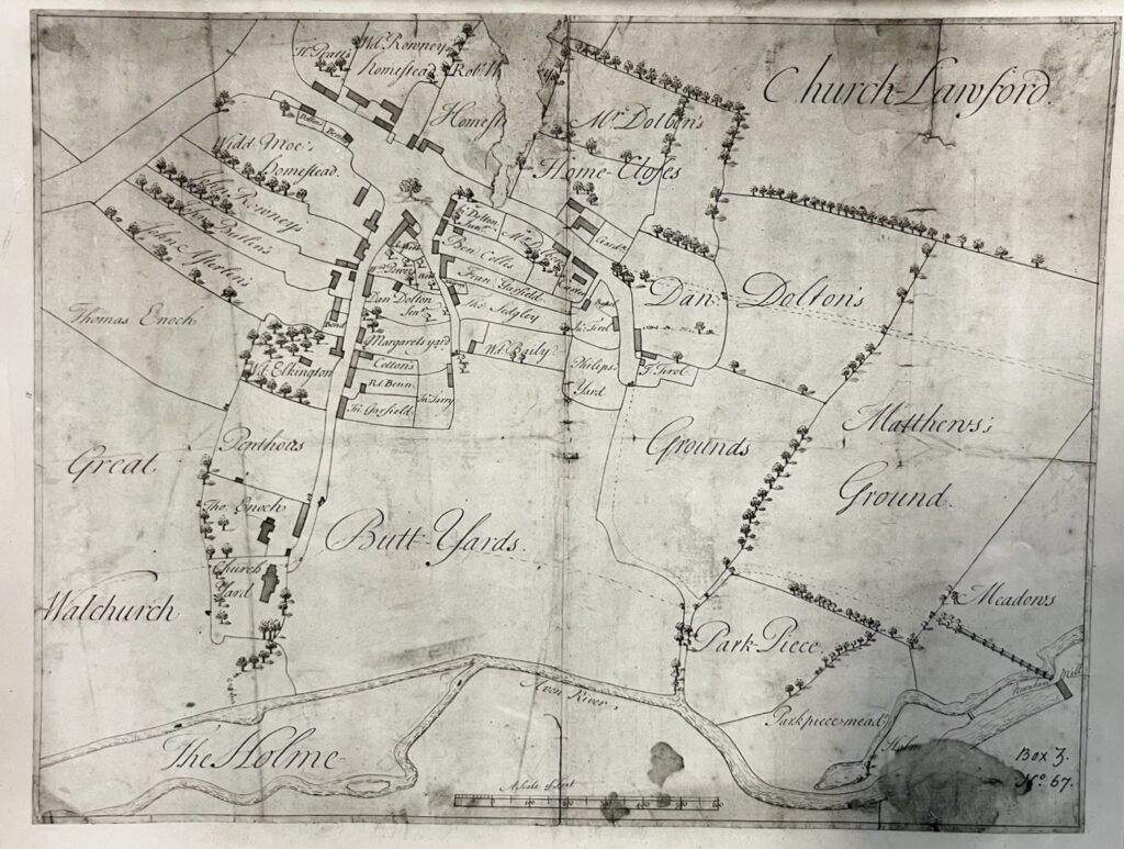
The above map, held in the Warwick Records Centre along with all the 1720 maps, shows the map of Church Lawford village as produced around 1720. The review of the information in this map is part of the study into the tithe information, and includes a zoomed in version with numbers to more clearly annotate the residents and their houses – this can be found here. The map highlights a number of villagers from families well known in that period – Dalton, Cotton, Garfield, Elkington, Benn etc The village only extended as far as what is now Smithy Lane. King’s Newnham to the north is to the right hand side.
1725/9 Henry Beighton Map of Knightlow Hundred
Henry Beighton surveyed Warwickshire in 1725 with the resultant map produced in 1729 for inclusion in later copies of the Antiquities of Warwickshire book, originally written by William Dugdale. The map is reviewed in more detail here.
